The most common natural disasters in Comoros are floods, cyclones, rising waters and tsunamis. Additionally, the activity of the Karthala volcano also represents a source of risk and vulnerability for the country. The government has made efforts to address Comoro’s vulnerability.
Green Climate Fund (GCF) has started working with the Comorian Government through 'readiness support,' which will help the government build capacity to better understand and plan responses to the climate change threats and be able to access funding from GCF and other sources.
The Accelerated Growth and Sustainable Development Strategy 2018-2030 refers to the institutional DRR and management framework. The General Directorate of Civil Security is the entity responsible for dealing with both disasters’ response and prevention at the national level. Additionally, the National Platform for the Prevention and Reduction of Disaster Risks is an advisory board in DRR and management issues.
The National Action Plan Against Desertification in the Comoros of 2013 and the Predetermined contributions at the national level of the Union of the Comoros (2015) are another example of the country’s response towards addressing climate change. However, the political instability of the Comoros has made it difficult for any government to tackle climate change as a priority.
The climate of the Comoro Islands, an archipelago in the Indian Ocean south of the Equator, is tropical, with a hot and rainy season from December to April, when the north-west monsoon prevails, and a relatively cool and dry season from May to November, when the south-east trade winds blow. The warmest period is from January to April, with an average daily temperature around 27°C, while the coolest months are July, August and September, when the average drops to around 23°C.
Of the three main islands that make up the archipelago, the two smaller ones (Mohéli and Anjouan) are occupied by hills in the interior, while the largest one, Grande Comore or Ngazidja, is home to the 2,360 meters high Karthala volcano, . The slopes enhance cloud formation, which can lead to showers and thunderstorms, especially on the main island, which, in fact, is the rainiest. On Mount Karthala, up to 5,000 millimeters of rain fall per year, while Moroni, which is located on the windward side in the rainy season (that is, it is exposed to the north-west monsoon), receives 2,700 mm of rain per year.
In Fomboni, on the island of Mohéli, total annual rainfall is 2,100 mm, while Ouani, on the island of Anjouan (also known as Nzwani), receives 1,800 mm of rain per year. January is the rainiest month throughout the archipelago, with more than 300 mm of rain along the coasts, while the driest month in Moroni is October, with 95 mm of rain, which shows that showers and thunderstorms can occur quite frequently even in the dry season, at least on the main island. However, these rains, though intense, are short-lived, and they usually soon make room for the sun. On the smaller islands, during the dry season, showers are less frequent and less intense.
Despite the rains, the Comoros suffer from a shortage of fresh water due to the absence of rivers. The amount of sunshine in the Comoros is not exceptional, nor scarce. The sun shines for a few hours a day even in the wettest months. The sunniest period is that of the trade winds, ie May-November, when, however, a bit of cloudiness can form, especially near the mountains.

Regional Platform / DRR Contact Point
-
Government of the ComorosOrganization type:
Risk reduction Policies, Plans & Strategies
Policies, plans and official statements on disaster risk, climate adaptation and resilience.

|
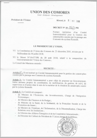
Cyclone Kenneth Impact Assessment & Recovery and Reconstruction Plan Annex 3 - Decree establishing the inter-ministerial committee
Decree establishing the inter-ministerial committee for the management of disasters caused by the passage of Cyclone Kenneth in the Comoros. |

|
Accelerated Growth and Sustainable Development Strategy (2018-2021)
This strategy aims at accelerated economic growth and creating decent jobs, while promoting sustainable development in the country. This Strategy has a Priority Action Plan (PAP) to facilitate its implementation. |

|
National Contingency Plan 2017-2018
This National Contingency Plan, like the sectoral response plans, has been drawn up in accordance with the spirit of the Humanitarian Action Charter, which reaffirms the right of disaster-affected populations to protection, assistance and living with dignity. |
Documents & Publications
Disaster risk reduction and resilience publications, reports, research papers and case studies.

|
Intended Nationally Determined Contributions (INDC) of the Union of Comoros
The INDC aim to contribute to poverty reduction, sustainable development while providing adequate solutions to climate change challenges. |

|
Institutional Arrangement for DRR and Progress in the Implementation of the Sendai Framework - Case of Comoros
Comoros presentation in the Strengthening Disaster Risk Reduction, Coordination, Planning and Policy Advisory Capacity of SADC Project Inception Workshop, held in Johannesburg, South Africa, 20-24 January 2020. |

|
Cyclone Kenneth Impact Assessment & Recovery and Reconstruction Plan Annex 2 - Disaster Risk Reduction Budget
Annex 2 - Disaster Risk Reduction Budget |
Disaster Data & Statistics
Reports on disaster statistics, country profiles and additional resources on collecting disaster loss data.
There are no documents under this category.

