Zambia is often hit by climate change-related hazards, especially droughts and floods. Therefore, the government is strongly committed to disaster risk management, having implemented several measures and strategies, such as a disaster loss database (UNISDR, 2019). Moreover, Zambia disaster management policy has been reviewed in order to enhance the paradigm shift from disaster management to disaster risk reduction, climate change and decentralization.
In Zambia, there are three committees involved in disaster management, namely the Disaster Management Unit (DMMU), the National Disaster Committee (NDMC) and the National Disaster Management Technical Committee (NDMTC). The three are assisted by Disaster Management Committees at the provincial, district and satellite levels.
The legal basis for the existence of the national disaster management structure and policy is provided by the Disaster Management Act of 2010 and put into action by other documents such as the National Disaster Management Policy (2015); and the Disaster Management Operations Manual (2015).
Zambia faces challenges and constraints, particularly in what concerns data availability and inadequate insurance cover for hazards such as floods (UNISDR, 2019).
- UNISDR (2019). Global Platform for Disaster Risk Reduction - Speeches and Statements. Retrieved from https://www.unisdr.org/conference/2019/globalplatform/programme/offic…
Zambia, a country located in southern Africa, is almost entirely covered by a plateau, which tempers the climate, making the temperature generally acceptable for most of the year.
In Zambia, the climate is tropical or sub-tropical depending on altitude, with a hot, humid, and rainy season from mid-November to March and a dry season from April to mid-November. In the dry season, there's a cool period from mid-May to mid-August, and a progressively hotter period from September to mid-November, when the heat becomes torrid, that is, intense but with low humidity. In fact, October is typically the hottest month of the year. On the other hand, moisture is high during the rainy season, which begins around the middle of November, and lasts until the end of March.
During the coolest period, from mid-May to mid-August, it can get cold at night, especially in the southern regions, where the temperature can drop to around freezing (0°C). The driest months are June, July, and August, when it practically never rains. During the dry season, weather conditions are generally very good: the sky is clear and the air is clear. In October and November, the first thunderstorms after the dry season can trigger natural fires, when trees are struck by lightning.
In the rainy season, the rains occur mainly in the form of downpours or thunderstorms. In Zambia, floods caused by heavy rains are quite normal. The wettest areas are the northern ones, namely, the North-Western Province, the Copperbelt Province, and the Northern Province, where precipitation exceeds 1,000 millimeters per year, and in some areas, it can reach 1,400 mm. The most arid area is, in the south-west, the southern part of Barotseland, where the Zambezi River separates Zambia from Namibia and Zimbabwe: in this area, annual rainfall is around 600 mm or even a little below. On the border with Zimbabwe, the Zambezi River feeds the magnificent Victoria Falls, which are about 100 meters high, twice as wide and one and a half taller than the Niagara Falls.
The temperature in Zambia varies according to altitude and latitude. The plateau's altitude ranges mostly from 900 to 1,500 meters, but some areas descend to almost 500 meters, in the far south along the Zambezi River (and in Lake Kariba, created by a dam on the river), and also in the east, in the Luangwa National Park, where the Luangwa River flows. On the contrary, in the north, the altitude reaches 1,800 meters near Mbala, while in the north-east, near the border with Malawi, where the cool grassland of the Nyika National Park is found, it even reaches 2,200 meters.

Regional Platform / DRR Contact Point
-
Government of ZambiaOrganization type:
Risk reduction Policies, Plans & Strategies
Policies, plans and official statements on disaster risk, climate adaptation and resilience.

|
Zambia Humanitarian Response Plan (2019-2020)
The objectives of the Humanitarian Response Plan for the period of 2019 -2020 were to: |

|
Zambia National Disaster Risk Management Framework (2017-2030) - Operationalising the Sendai Framework
Build on the Sendai Framework and others in order to facilitate the identification of priority areas which must be integrated into the national development planning processes. |

|
National Disaster Management Policy
Review of the Disaster Management Policy of 2005. |
Documents & Publications
Disaster risk reduction and resilience publications, reports, research papers and case studies.

|
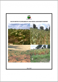
2018 In-Depth Vulnerability and Needs Assessment Report
Analyse the impact of dry spells, floods and pest infestation (fall army worms and stalk borers) experienced in Zambia on society and the economy and the required actions for rehabilitation, recovery and to mitigate these impacts. The sample includes 58 districts of Zambia. |

|
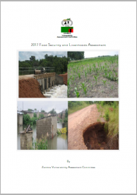
2017 Food Security and Livelihoods Assessment
Designed to answer to chronic situations in the country and recommend the possible solutions for risk reduction and resilience building both for the short and long term in addition to support for required food where necessary. |

|
Zambia Livelihood Zones and Descriptions
The Livelihood Zoning “Plus” product resemble the Household Economy Approach. It includes a traditional livelihoods zoning component. In addition, some key characteristics of socioeconomic status explore the juxtaposition of the relatively poorer and relatively better-off households. |
Disaster Data & Statistics
Reports on disaster statistics, country profiles and additional resources on collecting disaster loss data.

|
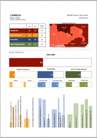
INFORM Country Risk Profile - Zambia
Index for Risk Management. |

|
Disaster risk profile - Zambia
This Zambian country risk profile provides a comprehensive view of hazard, risk and uncertainties for floods and droughts in a changing climate, with projections for the period 2050-2100. |

