Document
The acronym NIHYCRI regards the Malagasy standards for infrastructure construction hydroagricultural against floods.
NIHYCRI aims to increase the safety of hydro-agricultural infrastructure so as to:
The following is a list of all conten labeled as "Prevention and Emergency Management Unit (CPGU)"
The acronym NIHYCRI regards the Malagasy standards for infrastructure construction hydroagricultural against floods.
NIHYCRI aims to increase the safety of hydro-agricultural infrastructure so as to:
The objective of this manual is to improve "the implementation of cyclonic alert system in Madagascar, to clearly define the roles and responsibilities of the different entities at all levels and at different phases of the cyclonic alert system mechanism, and to propose the characteristics of the necessary materials relating thereto”.
The overall object of this guide is to assess flood risk and vulnerability, pre-dimensioning road works and protective measures against damage, linked to floods.

Aware of the development challenges represented by risks and disasters, Madagascar finalized its first National Strategy for Risk and Disaster Management (SNGRC) in 2003. By being annexed to the national policy on risk and disaster management which was adopted during of the same year, this strategic document is an integral part of the said policy.
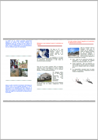
Brochure featuring the rules of construction of a para-cyclonic building in Madagascar.

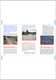
CPGU implements the popularization and awareness of the application of building rules on hydroagricultural infrastructures in Madagascar or the Construction Standards of Hydroagricultural Infrastructures against Floods and Flooding in Madagascar (NIHYCRI).
The CPGU implements the popularization and awareness of the application of building rules on road infrastructure or the Guide to Road Protection Against the Flood in Madagascar (GPRCIM).


Risk Atlas of the Sofia Region. It includes information and mapping regarding physical geography of the region; settlements, infrastructure, health and agricultural sectors and climatic hazards, such as cyclones, droughts and floods.

Risk Atlas of the Sava Region. It includes information and mapping regarding physical geography of the region; settlements, infrastructure, health and agricultural sectors and climatic hazards, such as cyclones, droughts and floods.